 East Cooper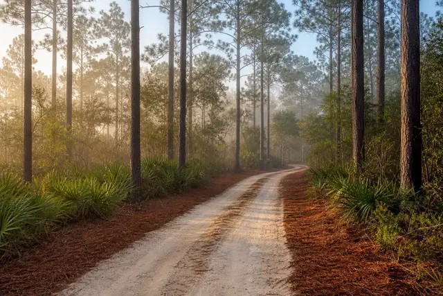
East Cooper Land Clearing pairs Mount Pleasant property owners with a local land clearing contractor for access road & driveway clearing in Mount Pleasant and the East Cooper communities around it.
North of the Isle of Palms connector, Highway 17 changes character. The subdivisions thin out, and the road runs 28 miles through Awendaw and on to McClellanville with pine timberland on both sides. The acreage tracts out here — hunting land, homesites, family parcels near Huger — are frequently locked behind their own vegetation. The first project on any of them is a corridor a pickup can actually drive.
Route selection is most of the intelligence in the job. The Wando fine sands that underlie the upland ridges are excessively drained and carry equipment even after rain, while the low swales between them hold water for days in a county that averages 45.30 inches a year. A road cut along the sand ridge stays passable through the seasons; a road cut through the low ground becomes a rut farm by February. Walking the route before clearing it is not a formality.
The clearing itself is typically a mulched corridor. Trees and brush are ground in place to a specified width, and stumps along the travel path are cut low or ground out. The mulch stays down as a first working surface that keeps the sand from washing. Culverts and stone come later if the drive is being built to a finished standard; the clearing pass is about establishing the line.
Around Awendaw, Huger, and McClellanville, many parcels sit against the boundary of Francis Marion National Forest — roughly 259,000 federal acres spread across Charleston and Berkeley counties. Private inholdings and adjacent tracts clear normally; the federal forest itself does not. Confirming the boundary on a plat before cutting is part of doing this work honestly.
Tell East Cooper Land Clearing where the parcel is and where you need to reach. A contractor who works the rural end of the corridor will walk the route with you. The quote comes back free and itemized, by corridor length and width.
Corridor geometry for real vehicles
A corridor that admits a pickup is not the finish line; it is the minimum. Concrete trucks, well-drilling rigs, and delivery trailers all need more width and gentler curves than a woods road cut by eye, and on deep parcels near the national forest there is a harder requirement worth designing for: emergency apparatus. The SC Forestry Commission responds to wildland fire across this county, and a drive that firefighting equipment cannot enter is a drive that leaves the back of the property undefended.
The corridor's junction with the public road deserves its own attention. Sight distance along the highway, a stabilized apron, and whatever approval Charleston County requires for a new connection to a county-maintained road all belong in the plan before the first tree comes down at the entrance.
Wet crossings and the seasonal water table
The water table under coastal Berkeley and Charleston county land rides high from winter into spring, and a swale that looks innocent in October can hold water into March. NWS Charleston climate data explains why: the rain keeps coming while evaporation sleeps. Where a route cannot avoid a low crossing, the clearing pass establishes the line and leaves the crossing for proper treatment, a culvert and stone when the drive is built to standard, rather than pretending mulch alone will carry loaded axles through a wet swale.