 East Cooper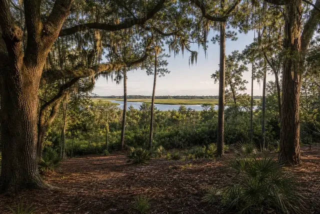
East Cooper Land Clearing pairs James Island property owners with a local land clearing contractor for forestry mulching, lot clearing, and site prep across the James Island area.
The Town of James Island counted 11,621 residents in 2020, spread across a marsh-creek island south of the harbor where nearly every neighborhood backs up to tidal water somewhere. That geography defines the clearing work: yards that end at the marsh, lots threaded between creeks, and a hard legal edge running through all of it — the state's critical-area line, past which SCDES's Bureau of Coastal Management permits everything and casual clearing is simply illegal. Work on James Island happens landward of that line, deliberately, with the boundary identified before the first cut.
Landward of the line there is plenty to do. Marsh-front buffers overgrow with wax myrtle, cedar, and vine until the water view that justified the mortgage disappears; selective thinning restores the sightline while the buffer keeps doing its job holding the bank. Hurricane season — June 1 through November 30, peaking in early September — adds the preventive angle, because everything dead or leaning in a yard this close to open water becomes debris in a named storm, and the island's live oaks deserve better company than a rotten pine.
Wet ground is the working constraint on the back half of many lots, where soil shifts toward tidal muck that ruts under anything heavy; timing work to tides and dry spells is part of the trade here. For a price built around those realities, use the quote form on this site — free and itemized, from a local contractor who prices selective thinning, removals, and debris handling as separate lines rather than one blended guess.
Thinning a View Without Losing the Buffer
The classic James Island job is a marsh-front buffer that has thickened with myrtle, cedar, and vine until it swallowed the view the mortgage was partly paying for. The fix is selective thinning, not removal: chosen stems come out to reopen the sightline while the buffer keeps holding the bank, which is the job it was doing all along. SCDNR's coastal habitat information is worth a read for owners deciding how much buffer to keep.
Hurricane season adds the second agenda, since anything dead or leaning within reach of open water turns into airborne debris once a storm gets a name. The National Weather Service in Charleston is the island's reference for a season that crests in early September, and the preventive cutting sensibly happens well before that.
What Gets Checked Before a Marsh-Edge Number
Two boundaries get identified before any James Island quote firms up: the state's critical-area line, past which clearing without a permit is simply illegal, and the practical line where the back of the lot turns to tidal muck that ruts under anything heavy.
A local contractor walks both, plans the work landward and on the firm side, and times the soft-ground portion to tides and dry spells. The free estimate itemizes selective thinning, removals, and debris handling as lines an owner can weigh individually. The relevant public guidance for James Island parcels is Clemson HGIC coastal shrub references.